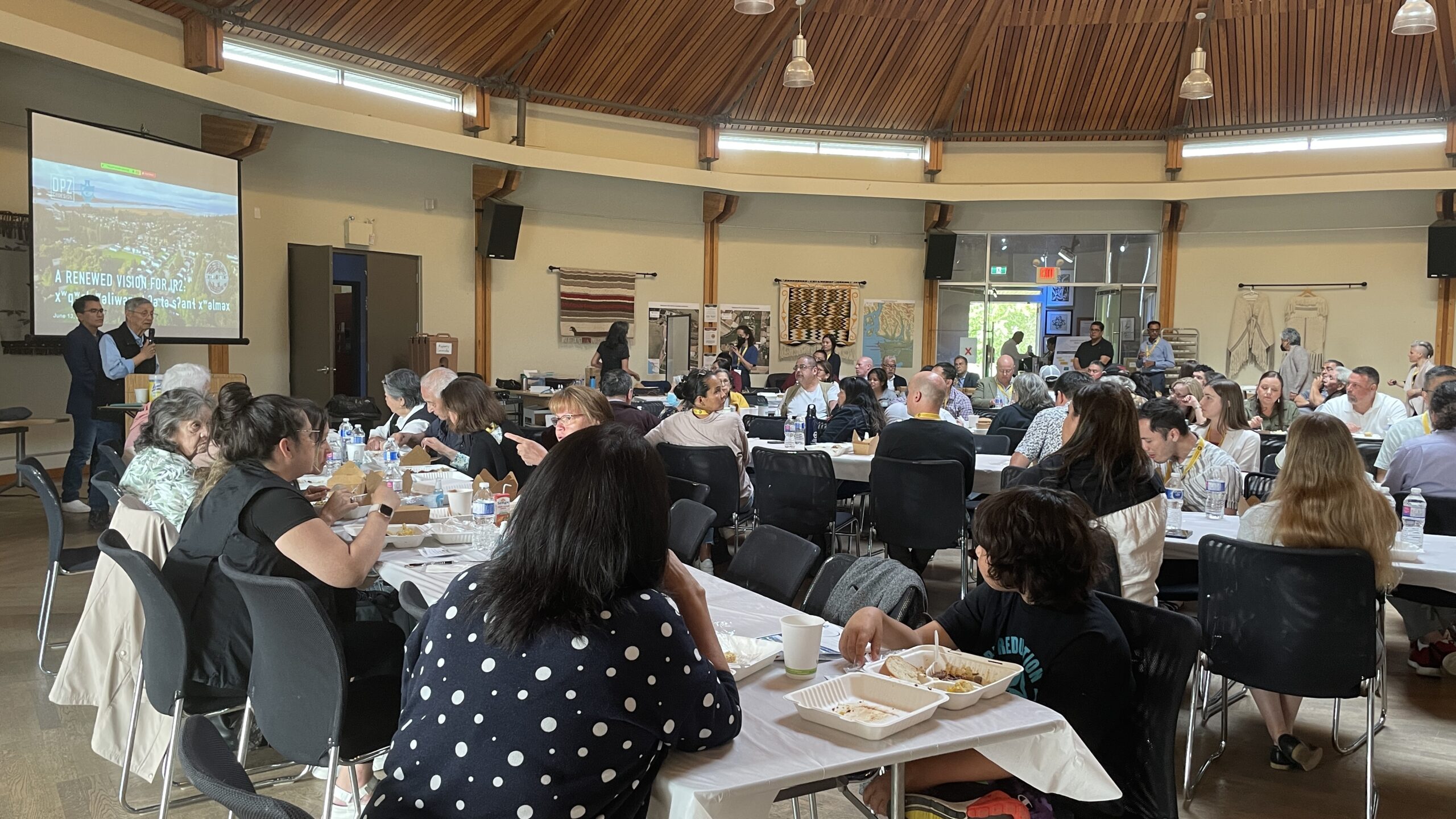
hay ce:p q̓ə to everyone who participated in the Community Design Workshop earlier this summer (June 13-18, 2022) for the Musqueam Village (IR2) Plan.
This update for the community about the Musqueam Village (IR2) Plan includes:
- Summary of the Community Design Workshop (below)
- Visual report – with maps, drawings, and possible plans for IR2 (link here)
- Briefing note – with more detail about Chief & Council directions and next steps (link here)
We were pleased with the turnout during the week:
- 211 people participated in the 6-day workshop, 133 of whom are Musqueam members
- 9 different workshop sessions and events
- 6 days of in-depth listening, engagement, and design with 28 technical and professional consultants working for Musqueam
During the workshop, the planning team heard from you, listened to you, and worked to design up several options for the future development of Musqueam Village (IR2).
Four key directions emerged that will guide plans for IR2:
- Flood Management – Manage flooding and the impact of sea level rise
- Housing – Create more housing options for Musqueam members
- Stewardship – Protect areas with cultural and environmental value
- Economic Development – Become a self-sufficient, self-governing Nation
We know that these are not new directions – they reflect many years of work and conversations within our community. To take action to address these needs, we need more specific plans.
Where are we now? Possible plans for IR2
Below is a summary of possible plans being considered for different areas of the Musqueam Reserve (IR2). There is also a visual report and a more detailed briefing note available for you to read.
A reminder – these draft options are still being assessed. For ways you can continue to be part of this planning process, see “What happens next?” at the end of this page. Any future decisions about specific developments will happen with community input according to Musqueam’s governance processes, Land Code, and Land Use Plan.
Creating a new Musqueam hub by building mixed-use commercial and residential housing on Block K (see Visual Report p. 18-21)
The lands known as Block K are northwest of the Shaughnessy Golf and Country Club, along SW Marine Drive. There are several options for the development of this land, including housing for band members, commercial real estate opportunities to generate revenue for Musqueam community needs, as well as preserving cultural and heritage sites. A feasibility study to explore these options is underway.
Building member housing on the Mali lands (see Visual Report p. 22-24)
This plan considered building townhouse-style homes along the end of Jericho drive on MIB-held and privately-held land. A feasibility study to provide more information on the geotechnical, environmental, and flooding concerns has been directed by Chief and Council. The outcomes of this study will provide more information as to the viability of more member housing on Mali.
Expand Musqueam Village by building member housing on Musqueam Golf and Learning Academy (see Visual Report p. 25-26)
This approach included several different variations, from preserving part of the golf course and driving range, to using the entire area for additional housing as well as flood-proofing existing homes. Due to flooding concerns and the ongoing MIB flood study, these proposals are still being researched and vetted for their cost as well as their impact on homes north of 51st Avenue.
Filling in the wetlands and building a new waterfront Musqueam village (see Visual Report p. 27)
Recommended by a Musqueam band member, this plan would fill in the foreshore along the Fraser River, and build an entirely new Musqueam village on the water. It would also leave the Shaughnessy Golf Course a privately held club to generate revenue for Musqueam band needs. This plan was drawn up but has significant environmental, cost, and feasibility challenges and will not be further pursued.
In addition, the project team is working on an overall plan for all of Musqueam Village (IR2) (see Visual Report p. 11-16)
that plans out network infrastructure like blocks for development, areas for preservation, roads, trails, open space networks, utilities and cultural assets conservation, to ensure that all future development is done so in a cohesive, holistic and culturally-appropriate way. The long-term plan includes all of IR2, including the Shaughnessy Golf Course and other leased lands.
So, what happens next?
Feasibility Studies
On July 25th, 2022, the plan options discussed above were presented to MIB Chief and Council, who directed the project team to:
- Study the feasibility of developing the Block K / Marine Drive area as a mixed use development
- Investigate the options for member housing on the Mali lands
This work will be conducted by MCC, with input and direction from MIB staff in their technical expertise. Feasibility studies will include information community members asked for, such as financial analysis (cost, financing), timing and phasing options, as well as detailed geotechnical, environmental, flooding, and archaeological information that is needed.
A Flood Mitigation Strategy led by the Public Works department is currently underway. The project team continues to coordinate with that work and will wait for the outcome of that Strategy before continuing design work on the Musqueam Golf and Learning Academy. The Flood Mitigation Strategy also extends to the Mali area and will impact the feasibility of building housing on Mali.
Community Review
The project team is continuing their work to integrate all the feedback that has been received into a draft overall plan. We will also begin work on developing design guidelines, best practices and principles that will guide future development in Musqueam Village (IR2).
An extended, online engagement period was scheduled for June and July following the in-person design workshop. This was meant to allow community members to review and comment on the various development plans. However, this online engagement was postponed for cultural reasons, and also to allow the consultant team more time to focus on the cost and impacts of these possible plans.
Based on guidance from MIB Chief and Council, there will be community review opportunities to provide your feedback on the possible plans for Block K, Mali, and MGLA. Online methods will be available on the website in Fall 2022, with in person options at upcoming MIB events.
After these critical steps, the complete draft IR2 Plan will be reviewed by the Musqueam Land Code Committee, Chief & Council, and will be subject to a community vote (Meeting of the Members vote as per Musqueam Land Code).
hay ce:p q̓ə
Thank you for reading – there were a lot of questions asked at the Community Design Workshop, and we hope this update answers some of them.
We know that members recognize the importance of this planning process for all generations of Musqueam people. We appreciate your commitment and understanding as we continue to work together to create a plan that works toward our community vision – nə́c̓əmat tə šxʷqʷeləwən ct (we are of one heart and mind).
Please get in touch!
Have questions? Need more information? Please feel free to contact Grace Ulu or Tecla Van Bussell below!
Click here to email Grace Ulu
(Communications & Marketing Coordinator, Musqueam Capital Corporation)
Click here to email Tecla Van Bussel
(Community Planner, Musqueam Indian Band)